Search Tool - Configuration
The Search Tool is configured in this section. In the finished app, the Search Tool can be accessed via the search icon on the right-hand side of the menu bar. The functionality of the Search Tool in the app is described here.
The search tool can be operated using multiple plugins, which determine the supported search parameters of the search field.
Nominatim-Search
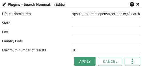
The Nominatim-Search plugin uses data from OpenStreetMap to find locations based on addresses or names. Clicking on opens the configuration window, which shows the available configuration.

The following options are possible:
| Option | Description |
|---|---|
URL to Nominatim |
URL to a running Nominatim Service |
State |
To limit the search area, a federal state can be specified here in which the user can search for addresses. |
City |
To limit the search area, a city can be specified here in which the user can search for addresses. |
Country Code |
To limit the search area, the code of a country can be specified here in which the user can search for addresses. |
Maximum Number of Results |
The maximum number of results to be returned by the search |
| Apply applies the changes made to the displayed app. See also Editing and Saving |
ESRI-Search
The ESRI-Search plugin uses a geocoding service provided via an ArcGIS Rest API to find locations based on addresses or names. Clicking on opens the configuration window, which shows the available configuration options for the ESRI-search.
The following options are possible:
Configuration of the ESRI search
| Option | Description |
|---|---|
URL |
URL of the search service |
Maximum number of results |
The Maximum number of results displayed. |
Zoom Distance |
The distance to use, when flying to the result. |
Address Attribute Mapping |
Mapping the ESRI Geocoding attributes to the respective VC Map Address Balloon attributes. |
| Apply applies the changes made to the displayed app. See also Editing and Saving |
WFS-Search
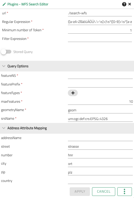
The Search-WFS plugin uses data from a Web Feature Service (WFS) to find locations based on addresses or proper names. Clicking on opens the configuration window, which shows the available configuration options for the WFS search.

The following options are possible:
| Option | Description |
|---|---|
URL |
URL of the search service |
Regular expression |
The RegEx to use for tokenizing. |
Minimum number of token |
The minimum number of regex groups that must be found in a given string in order to search. For example, if both a street and a house number are required, the number would be 2. |
Filter expression |
The filter expression as a template. |
Stored Query |
Defines whether the expression is a |
Query options |
The options for the WFS query passed to the GetFeature request. |
Address attribute mapping |
Mapping the feature attributes to the respective VC Map Address Balloon attributes. |
| Apply applies the changes made to the displayed app. See also Editing and Saving |
Coordinate Search
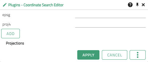
The Search-Coordinate plugin makes it possible to find locations using coordinates. Clicking on opens the configuration window, which shows the available configuration options for the coordinate search.
| WGS84 and the projection of the map are always supported by default as coordinate reference systems already. |

The following options are possible:
| Option | Description |
|---|---|
epsg |
The EPSG code of the coordinate reference system (CRS) to be supported by the coordinate search in addition. |
proj4 |
Description |
projections |
List of the projections additionally supported via Add. |
| Apply applies the changes made to the displayed app. See also Editing and Saving |