Reachability Map
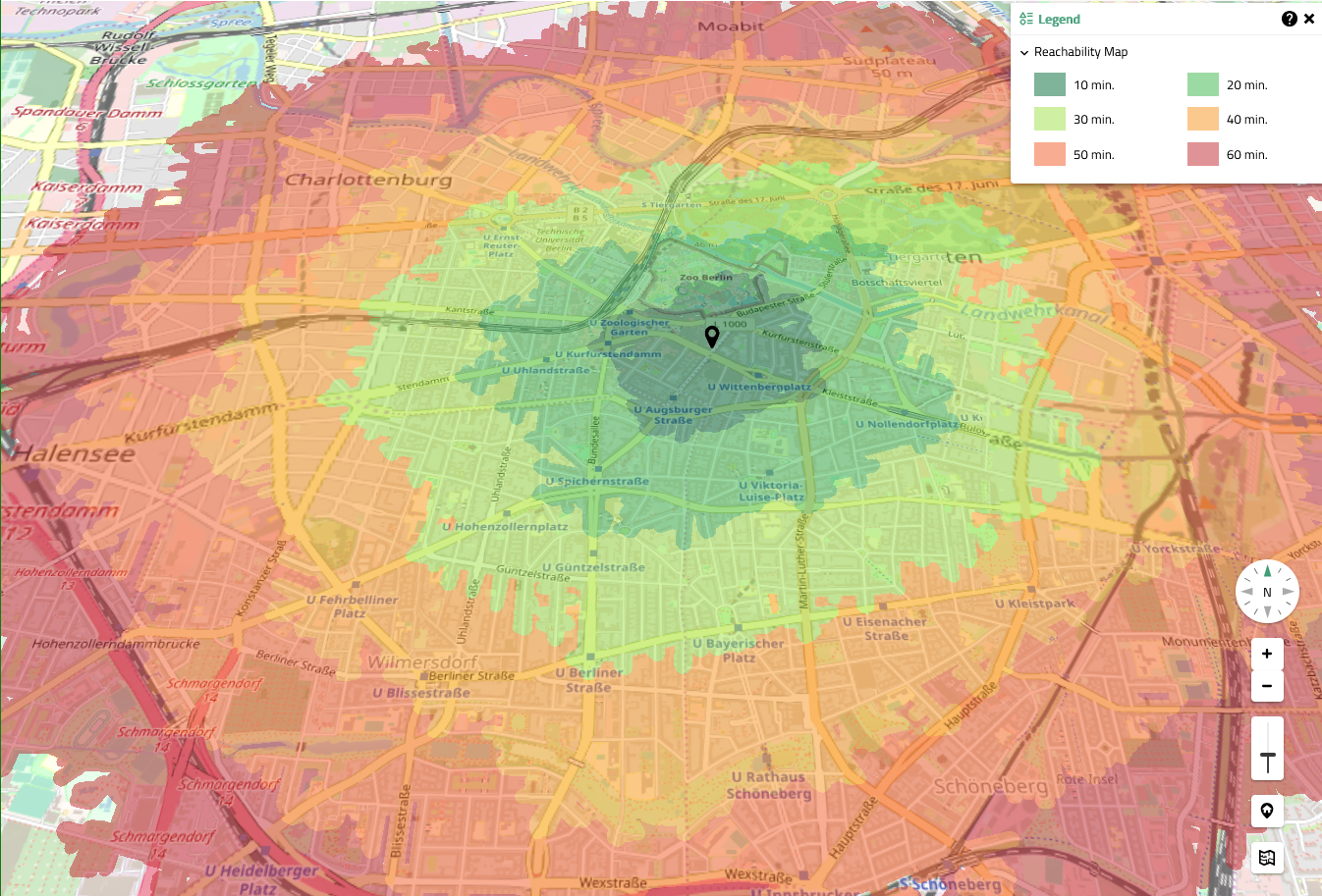
The Reachability Map tool calculates and displays the areas that can be reached from a given location by the chosen means of transport within a defined time interval. Clicking the according button in the toolbar opens the tool window.
The tool allows to choose between different means of transport and a maximum travel time in 10-minute increments for the calculation. The following means of transport are available: walking,
cycling,
car and
public transport.
| The calculation uses average speed values for available routes (walking, cycling, car) and average transport times based on current timetables (public transport). It does not incorporate any live data like current traffic or service restrictions. |
Clicking the button 'Select starting point' allows to define the starting point by clicking on the map. This starts the calculation of the reachable areas, indicated by a progress bar. After the calculation is finished, the results are displayed on the map and a corresponding legend is shown (see Rendering of reachability map).

An update of the displayed results happens automatically when tool settings are changed. Selecting a different travel type or increasing the time limit slider triggers a recalculation of the reachable areas.
Existing results can be removed from the map view by either selecting the reset button or by disabling the tool via the toolbar. A completely new calculation can be started by selecting a different starting point.
| The tool can also be started via right-clicking the map view and selecting the according context menu entry 'Determine reachability'. It starts the calculation of the reachability for the chosen position immediately, using the current/default settings of the tool. |