Reachability Map - Configuration
The Reachability Map tool is configured in this section.
In the finished app, the Reachability Map can be accessed via the icon in the toolbar. The functionality of the Reachability Map within the app is described in the corresponding section of the VC Map help.
| This tool requires a third-party service currently provided by the company Targomo, which needs to be licensed and therefore needs a valid API key. |
Clicking on opens the configuration window, which shows the available configuration options.
The configuration is divided into three sections:
General
The general section contains options, which are required in order for the plugin to be functional, for instance the API key to be used for querying the Targomo API.
| Option | Description |
|---|---|
Targomo URL |
URL of the Targomo Isochrone API service used to query the results. See also Targomo Service Coverage Areas for details on service coverage. |
Targomo API key |
The Targomo API key. See Targomo API Pricing for costs and further details. |
Default means of transport |
The default means of transport, which is particularly meaningful when starting the tool from the context menu. |
Default maximum travel time |
The default maximum travel time, which is particularly meaningful when starting the tool from the context menu. |
Icon |
An optional icon configuration for the tool icon, for instance as MDI icon or custom SVG image. See the custom icon section of the VC Map UI documentation for more details. |
zIndex |
The value for the z-index of the map layer being used for rendering the results. The default value renders it as topmost layer of the map, but its value can be adjusted to change the rendering order and avoid possible interference with other tools (ie. feature picking). |
Colors
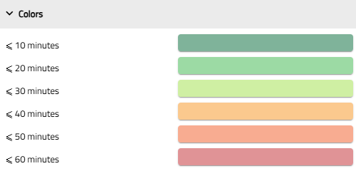
The color section allows the configuration of the style which is applied for the reachability map by associating a color to each 10-minute segment.

For each 10-minute interval, a color is associated. For modifying the color, select the according button and apply a new color in the dialogue window.
Transport modes configuration
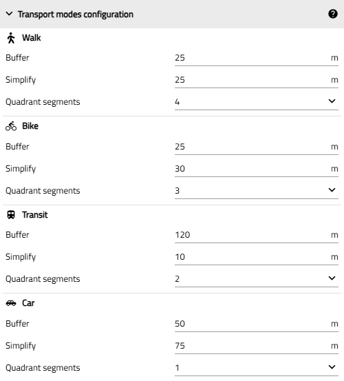
The means of transport have options which are passed on to the Targomo service.

Each means of transport has the following options, which are documented in the Targomo Isochrone API documentation.
| Option | Description |
|---|---|
Buffer |
Determines the geometry buffer size of the original polygon edges. The newly created polygon is wider by that margin. If set to 0, no buffer will be added. |
Simplify |
Merges points in created polygons that are very close to each other to "simplify" the returned result. The simplify parameter (meters) needs to be smaller or equal to 500m. If not specified, it will be calculated from the buffer size (if it was specified). |
Quadrant segments |
Due to the buffer the vertices of the polygon are extended in semi-circle way. This value determines into how many segments a 90 degree angle is translated. A low value means less polygon points but also less smooth corners. Cannot be higher than 8. |
| Apply applies the changes made to the displayed app. See also Editing and Saving |