
VC Story
The VC Story Plugin is a powerful extension for VC Map that enables interactive storytelling by linking traditional web content with 3D map interactions. This allows users to be guided through the map application, provided with additional information, and directed to key aspects to present projects, facts, or stories in a more understandable way.
| With the VC Story Editor, users can create interactive stories easily and directly in the VC Publisher - without any programming knowledge through a graphical user interface. |
| VC Story Plugin version 4 is not backward compatible with earlier versions of VC Story. |
Presentation and control elements
VC Story can be opened or closed via a button (Story Tool button) in the menu bar in the "Tools & Extensions" section. The contents of the story are presented either in windows in the map view or in a panel next to it.
-
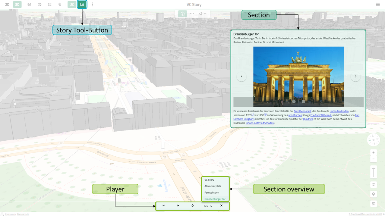
Slide Mode: Sections are displayed as windows (slides) in the map and can be freely positioned. A Player enables playback and jumping between sections. The play button allows automatic playback to be started. Each section is displayed for a preset time before switching to the next section. Playback can be stopped at any time or jumping to the next or previous slide is possible. The section overview displays all sections and enables quick access to any section.
-
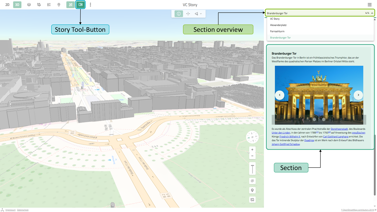
Scroll Mode: Sections are displayed one below the other in a panel next to the map. Navigation is done by scrolling or via the section overview.
Sections
A VC Story consists of several sections, which define the content structure of the application. A section can be composed of text elements, images, and button elements. When a section is activated, assigned Actions, such as view changes, camera flights, activation of a map layer, or similar are executed. Each section thus can define its own map state, comprising a specific view, displayed map content, and accompanying narrative.
Actions
Actions make the application dynamic by activating or deactivating various map contents, changing map position, or activating map tools. They can be assigned to Sections or button elements within sections as click actions. The following actions are currently possible:
-
Viewpoint action: Moves the camera (animated) to a map view and thus controls which areas are visible in different story sections.
-
Hide action: Hides one or more buildings or 3D objects.
-
Layer action: Activates or deactivates one or more map layers and controls which layers are visible in different story sections.
-
Layer style action: Changes the visualization of map layers through style adjustments.
-
Flight action: Executes pre-configured flight paths for dynamic camera movements.
-
Highlight action: Highlights certain buildings or objects visually to draw attention.
-
Map action: Allows switching between different map types (2D, 3D, oblique aerial image, panorama, …).
-
Rotation action: Rotates the camera around a fixed viewpoint for 360-degree exploration.
-
Swipe Tool action: Activates the swipe tool to compare different map states side by side in a split view.
-
Planning action: Activates a planning project and thus allows describing and presenting planning scenarios in the story.
-
Shadow action: Activates the shadow analysis tool for shadow visualizations.
-
Viewshed action: Activates a visibility analysis for spatial visibility studies and visualizes them.
Furthermore, additional custom actions can be integrated via an interface.